Pages

Tuesday, 31 May 2022

Book Review: The Munros A History by Andrew Dempster.

Back in 1995 The Munro Phenomenon by Andrew Dempster was published. I read it immediately and found this story of the Munros fascinating and inspiring. In particular I was taken with the comment that “it is interesting and almost strange that no one has yet attempted all the Munros and Tops in a single expedition”. I was so taken in fact that I set out to do just that the very next year.

Last year the follow-up to The Munro Phenomenon was published and The Munros A History is just as fascinating as the original book. In the twenty-six years since 1995 much has changed, including the numbers who’ve completed the Munros, up from a little over 1,000 to around 7,000. The Scottish Parliament has come into being, the first National Parks in Scotland have been created, there are legal access rights, hills lists have been updated and new ones produced, Munro records have been broken, there’s now a Munro Society.

Andrew Dempster includes all this and more in The Munros A History. It’s not an update of The Munro Phenomenon but a new book that goes far more deeply into the whole subject. The history of the lists (Munro’s was not the first), the first Munroists (I’m pleased to see so much attention given to the Rev ARG Burn, the first to complete the Munros and Tops), the post-war surge in Munro bagging, and continuous rounds and records (I’m mentioned here) are all covered. There’s also a look at the mass of Munro baggers who don’t do continuous rounds or run round the hills in record times with a consideration of why they do it.

Readers will also learn about the early map-makers, the first tourists, the 1930s working class outdoor revolution, the topography and topology of the Munros, and other hill lists like the Corbetts. The author, a two-time Munroist himself, describes some his favourite Munros in a chapter that really shows his deep love and attachment to the hills. A final chapter covers the crucial issues of conservation, re-wilding, and well-being.

I think this is a marvellous book (and not just because I have brief mention!). It contains a huge amount of research presented in an entertaining and readable style. The author isn’t afraid to give his own opinions either, which I always like even if I don’t necessarily agree with them.  Whilst those who have climbed or are climbing the Munros are the obvious audience it should appeal to anyone interested in the Scottish hills and hillwalking. Highly recommended.

The Munros A History is published by Luath Press at £11.99 .

Friday, 27 May 2022

Storms & Rainbows: A Walk Over Meall a' Bhuachaille


May has been a stormy month with high winds, cloudy skies and rain. Sunshine has been rare. I had planned a long walk, two weeks or more, in the Cairngorms, as part of immersing myself in the right frame of mind for writing a book about the area. I was almost ready to set off when an appointment suddenly appeared. As I’d been waiting well over a year for this I wasn’t going to turn it down. The long walk would have to wait. Instead I headed out for three days, as described in this post, with the intention of starting the walk later in the month, after the appointment. I also thought I’d wait for a change in the weather. I’m still waiting.

No long walk doesn’t mean no walks of course and I have been ambling round the local area, admiring the lushness of early summer, the brilliant green of new leaves, the spreading wild flowers. Nature doesn’t mind the wind and rain. A few days ago, wanting to stretch my legs a bit more, I went on a favourite short hill walk – Meall a’Bhuachaille. The forecast suggested, as so often this month, high winds and low cloud on the highest summits. On Meall a’Bhuachaille I’d be some 400 metres lower and wouldn’t be up high very long anyway so I hoped conditions wouldn’t be too severe. I went in the late afternoon too, as the weather was supposed to improve then. I do love the long hours of daylight at this time of year. 

Rain was falling lightly as I set off through the forest to Ryvoan Pass and An Lochan Uaine – the Green Loachan. I could hear the wind in the treetops. The wind-rippled lochan was green, blue and white, reflecting the trees, sky and clouds. 

As the path led up out of the trees the rain grew heavier and the wind stronger. By the time I reached little Ryvoan Bothy the storm was fierce and I decided some shelter would be welcome. Inside a figure in a sleeping bag greeted me. From Germany, he told me he’d been coming to the Highlands for two weeks walking in May for many years. This year, the pandemic having prevented him visiting since 2019, he’d decided to be ambitious and walk the Cape Wrath Trail. The weather had been appalling though and after several days he’d abandoned the walk and headed east. “This is my holiday after all!”.  Now he was wandering through the Cairngorms from bothy to bothy, mostly staying low because of the weather.


Outside the rain turned to hail, a deafening roar hammering on the bothy roof. I wondered about continuing. Soon it eased though and there was a touch of sunshine. Meall a’Bhuachaille beckoned. During the ascent I turned and looked back frequently to see rainbows curving over the wet hills. 


The sun was suddenly blindingly in my eyes. I hadn’t expected to need sunglasses. Not for long, the sky soon darkening again. Across Glenmore Forest the high Cairngorms were briefly out of the clouds.


The first drops of rain fell. I raced the storm to the summit and lost, of course. The wind up here was strong, the rain hard. I didn’t linger but was soon heading down, the rain keeping me company all the way back to the car.

In ten days I’m going south to spend three days wandering round bright halls packed with outdoor gear at a trade show. I expect the weather will be lovely.

Next month the long walk.

Sunday, 22 May 2022

Forty years ago on Mount Whitney on the Pacific Crest Trail, and a more recent ascent

On the ascent

Forty years ago on May 22, 1982, I climbed 4.421 metre Mount Whitney, the highest peak in the 48 contiguous states in the USA, as a side trip from my Pacific Crest Trail hike. The High Sierra was snowbound, so this was a crampons and ice axe ascent. With my three companions I camped at Crabtree Meadows, a superb site where we were pleased to be able to pitch our tent on dry ground rather than snow.

Camp at Crabtree Meadows

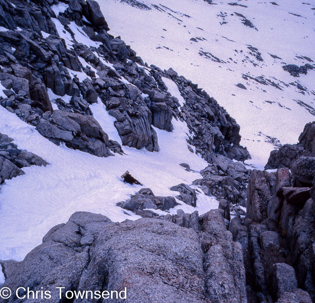
The ascent was exciting and, in a few places, quite scary as we edged round bulging rock buttresses on steep snow with dizzying drops under our feet. The views from the summit were vast, with mountains disappearing into the distance on three sides and to the east the shimmering pale slash of semi-desert Owens Valley far, far below.

On the summit

Not wanting to traverse the crest round those buttresses again we decided to glissade down one of the many snow-filled gullies on the west face of the mountain. This proved equally exciting, especially when Larry lost his ice axe at a narrow stony section of the gully and ended up spreadeagled on his back out in the middle of the slope, held there by the crampons on the back of his pack. I climbed down to him, retrieving his axe along the way, and we then kicked steps down to gentler snow.

Glissade

I didn’t take many photos on the climb, it was too intense, and we didn’t linger, not knowing how long it would take or if the weather would change. As it was the day took thirteen hours. I was the only one with a camera, which I handed to Larry to take pictures of me at times.

On the summit in 2016

Thirty-four years later I climbed Mount Whitney again in very different conditions. This was on my walk from Yosemite Valley to Death Valley and I made the ascent in mid-October after a long dry summer. This time I camped a little nearer the mountain at Guitar Lake, another spectacular site, and descended the far side. Free of snow the ascent was much easier though it was actually colder on the summit due to a strong wind.

Camp at Guitar Lake, 2016

You can read the full story of my first ascent of Mount Whitney and the rest of my Pacific Crest Trail thru-hike in my book Rattlesnakes and Bald Eagles.


A Cairngorms Walk With Contrasting Camps - One High & Calm, One Low & Windy

Moine Mhor camp looking to Braeriach, Sgor an Lochain Uaine, and Cairn Toul

For many months now wind has been the dominant feature in the weather, never seeming to stop. So far this May cloudy skies have been the norm too. This can be the best month for walking in sunshine. Not this year. A week ago there looked to be a brief weather window. I seized it and headed up onto the Moine Mhor plateau above Glen Feshie in the Cairngorms for a high camp in calm dry clear conditions.

Evening glow

I walked up in the evening as the wind died down and the land glowed gold in late sunshine. I camped right out in the heart of the plateau near the Allt Sgairnich, one of the high streams that flow south and become the River Eidart. I was to cross the other, the Allt Luineag, the next day.

Moine Mhor camp looking to Sgor Gaoith

Dawn came with drifting high clouds and the beginnings of a breeze. The tarp was soaked inside and out after a heavy dew. Early sunshine soon dried it. But before I set off the sky was already clouding over from the south and the wind was strengthening. 

View from Monadh Mor to Braeriach, Ben Macdui, and Bod an Deamhain


After crossing the Luineag, dry-shod due to some careful rock hopping, I climbed long slopes to Monadh Mor, one of the remoter and least visited Cairngorm Munros. It’s not an exciting hill but it is an excellent viewpoint. Today there were two others up here. The wind was now strong and I was soon down at the narrow col with Beinn Bhrotain, a rather grander Munro. I turned away though and dropped down steep slopes to the headwaters of the Allt Dhaidh Mor. A ribbon of snow curved along the hill crest above me. 

Beinn Bhrotain from Monadh Mor


The Dhaidh Mor runs south-east to the Geldie Burn, a feeder of the River Dee. I wanted to return to Glen Feshie to the west, so I soon left the Dhaidh Mor to cross a shallow col between Monadh Mor and a minor top called Cnapan Mor to another stream that ran down to the River Eidart. This is all rough pathless country, a mix of heather and grass tussocks. Walking isn’t easy or fast. 

River Eidart

The moorland is bleak, but the streams are a delight, especially the Eidart as it tumbles down in a mix of cascades and water slides, sometimes in mini gorges. As I descended the first trees appeared, a few scattered birch, rowan and willow on steep banks out of reach of deer and still not in leaf at this height. There should be more.

The Eidart Bridge


The rough walking ended at the spectacularly situated Eidart Bridge. From here it was a path along Glen Feshie. My speed increased, as did the wind. I had thought I would camp out in the open before I reached the forest lower down. The wind discouraged this idea and I kept moving, glad of the long hours of daylight.

Glowing birch trees

After the subdued browns of the open moor the first birches were a burst of brilliant green, lit by the hazy low sun shining through thin clouds. The light was dazzling as I was heading straight into it.

Glen Feshie camp


As I descended into the forest I could hear the wind roaring in the trees. As I watched them swaying and shaking I decided I wasn’t going to camp below any of them. Eventually I found a flat open spot that didn’t seem too windy as there were dense bushes not far away. By the time I was ready for sleep the wind was ferocious though. I went out and checked all the pegs and tightened guylines. Several time during the night the wind woke me. It’s one of the windiest camps I’ve had for a while. The night before I’d been over 600 metres higher and out in the open and the air had been still. 

In the rain in Glen Feshie

The racing clouds were darkening as I packed up. The first rain began just as I took down the tarp. Waterproofs on I walked back down Glen Feshie revelling in the lush spring richness and the beauty of the regenerating forest. Glen Feshie is never less than wonderful.


Thursday, 19 May 2022

A Look At The June Issue Of The Great Outdoors


In the June issue of The Great Outdoors, out now, I've contributed a a piece on two favourite Cairngorms hills to a big feature on Classic Hillwalks. Also describing their favourites are James Roddie, Vivienne Crow, Hanna Lindon, and Ronald Turnbull.

In the gear pages I just have two reviews: the BAM 73 Zero Insulated Gilet and the Vaude Wizard 24+4 daypack. More daypacks appear in a comparative review in which Lucy Wallace reviews five for women and Peter Macfarlane five for men. Alex Roddie also reviews three drybags.

In other long features this issue James Forrest fastpacks a section of the proposed England Coast Path in Yorkshire, Stefan Durkacz backpacks over some Corbetts in the Killilan Forest area of the NW Highlands, and Richard Hartfield attempts a 1200-kilometre hike across the Greater Caucasus mountains, a contested region on the Russian border. 

In shorter pieces sound artist Simon Opit is Creator of the Month; James Forrest gives a route guide to Mam Tor and the Great Ridge in the Peak District; Hanna Lindon asks Calum Maclean about his 80km straight line walk ascross the Cairngorms from the Pass of Drumochter to Corgaff, the longest possible without crossing a road; there's an interview with Stephanie Harris of The Old Forge Community Benefit Society about the successful campaign for a community buy-out of this remote Knoydart pub; Paul Besley says better access could be a benefit for nature; Alex Roddie reviews Simon Ingram's The Black Ridge: Amongst the Cuillin of Skye; and Jim Perrin praises Cross Fell in the Pennines.

In the Wild Walks pages Stefan Durkacz climbs Fuar Bheinn and Creach Bheinn in the West Highlands, Geoff  Holland goes to the Breamish Valley and Hedgehope Hill in the Cheviot Hills, Vivienne Crow is on Dale Head and Hindscarth in the Lake District, Ronald Turnbull is also in the Lake District and visits Dovedale and Deepdale, and James Forrest walks the Carneddau in Snowdonia.

Saturday, 14 May 2022

Forty Years ago on the Pacific Crest Trail: Approaching the High Sierra


A few days ago I posted the above picture as it was taken on the Pacific Crest Trail forty years ago on the same date. It shows two of my companions approaching the snowbound High Sierra, which you can just see in the far distance. Scott and Dave had picked up skis and internal frame packs they'd sent ahead for the High Sierra section. Up to this point they'd had external frame packs and snowshoes. My other companion Larry and I went through the High Sierra with snowshoes.

The post attracted some comments, including requests for more pictures and queries about the change of packs and why external frames anyway. Here are two more photos taken during the approach to the High Sierra. 

Scott at a camp by the South Fork of the Kern River. My tent, a Wintergear Eyrie, is on the right.


Myself fording the Kern River. Scott is on the far bank so either Dave or Larry took the photo with my camera.

With regard to external frame packs these were standard at the time for hiking in the USA and had been since they first appeared in the 1950s.Internal frame packs, introduced by Lowe Alpine in the late 1960s, were still regarded as for mountaineering and skiing rather than trail hiking. In the UK however internal frames were already becoming standard as so many of our hill paths are steep and rugged. I'd used an external frame pack on the Pennine Way in 1976 but switched to an internal one for Land's End to John O'Groats two years later, the advantage being better balance and stability on rough terrain.

Scott and Dave with their external frame packs on Mount Baden Powell earlier in the walk. I'm sitting on my internal frame pack.

My internal frame pack did break much later in the walk, due, I think, to descending a steep snow slope on its own, and the only replacement pack big enough I could find was an external frame one. I walked the last 1,000 miles of the trail with this and it was fine. I still have it and keep thinking I must take it out one day and see how it feels now.

My external frame pack much later in the walk.

After all these posts about long ago trips this month my next one will be about a trip I am about to make. This blog isn't just about ancient hiking history!


Tuesday, 10 May 2022

An old photo brings back memories of a tough day on the Continental Divide Trail in 1985


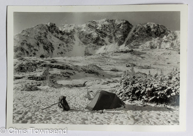
Sorting out some papers the other day I came on this print which long ago must have somehow become separated from related photos. I wasn't sure where it was taken but luckily I had written on the back "Camp in the Never Summer Range, Rocky Mountains, Colorado, Continental Divide Trail". The words brought memories flooding back. It was the first snow of a very early winter in 1985 that would result in my taking a lower route in the southern half of the State and then returning in 2019 to walk the high level section. 

The photo was taken on September 8, 1985, after a stormy day and night. From my journal written in the tent on the 7th: "Rain turned to hail ... hail turned to snow ... I found a staff* ... inches of snow on the ground now & my feet soaked and frozen - I must get some boots - but grip good** .... a real winter trek - up featureless slopes in driving snow & wind & thick mist. Entered Never Summer Wilderness at one point, how appropriate. Climbed to 12, 126 feet on Farview Mountain then turned off down to col - no far view today. Reached 11,900 foot Farview Pass - cleared snow off sign to see where I was - & descended to Parika Lake where I'm camped by some stunted spruce at 11.300 feet. Quite an epic getting tent up and keeping inside moderately dry ... Lessons from today - I need some boots & an ice axe & possibly gaiters plus maybe a thermal shirt & long johns.*** This will probably happen again. Anyway, time to cook a big hot curry!"

The day I took the photo the weather improved and I had a magnificent walk with the landscape looking spectacular in the snow.

I do like coming on old photos by surprise!

*This was before trekking poles. The staff is holding up my pack in the photo,

** I was hiking in New Balance running shoes. The weather had been dry and warm for many weeks. Two days later I bought some leather boots.

*** The little outdoor store where I bought the boots didn't have thernals, gaiters, or an ice axe. "It's still summer!". I wouldn't get those items for another three weeks.

Friday, 6 May 2022

New book coming soon


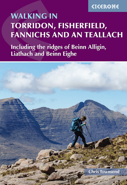
My next book will be published July 15th. It's a guide to the huge region of dramatic mountains between Glen Carron and Little Loch Broom in the NW Highlands of Scotland. All the big names are in of course, as shown in the title and subtitle, but the book also includes all the other hills in the area and some of the smaller ones are real gems. There's 50 routes in all. 

The book is also packed with my photographs, mostly taken over the last two years. Indeed, getting the photographs was more difficult than researching the routes. The latter could still be done on dull or misty days. A book full of cloud-shrouded hidden hills would not be a good idea (there are some) so I made many visits to take pictures in good conditions. 

My greatest success was on An Teallach. I'd traversed the mountain several times and visited it many more in the past but not once had it been clear. It seemed that whenever I went near it the clouds descended. With a forecast for clear weather I walked in one evening last July and camped not far from the mountain which was shining gold in the late sun. I didn't want just a long shot of its line of jagged peaks though, I wanted pictures taken on the mountain itself, showing it in all its glory. The next day the mist was down. My heart sank. Maybe this would be another ascent seeing nothing. 

On An Teallach

Then the mists began to clear high above and sink down below the summits. I climbed out of them to a brilliant sunny day, sharp, clear and perfect for photographs. I felt energised - and relieved. I wrote about that trip here.

The book can be ordered direct from the publishers -  https://www.cicerone.co.uk/9781786310286

Thursday, 5 May 2022

Crossing the Mohave Desert on the Pacific Crest Trail Forty Years Ago


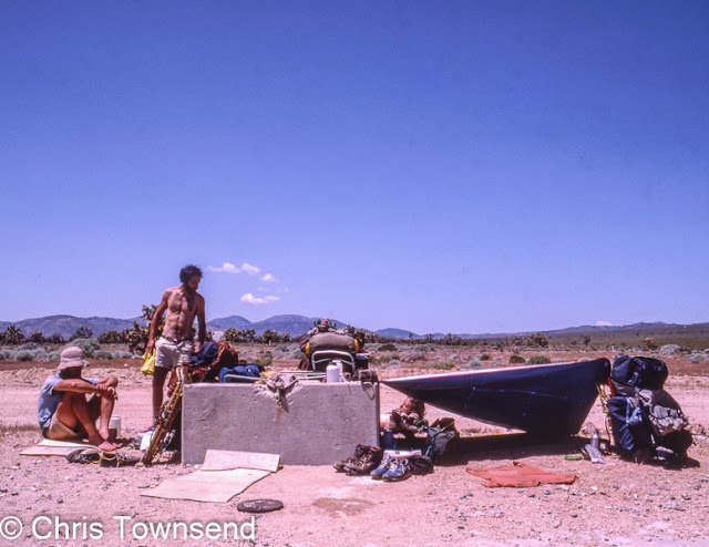
In early May 1982 I crossed the Mohave Desert on my Pacific Crest Trail thru-hike with three companions I'd met along the way. In just a few weeks the walk would change completely and we would be hiking through the deep snow of the High Sierra. But first we had to cross the hot Mohave Desert, complete with snowshoes, ice axes and crampons!

The desert was beautiful and fascinating but as much of the walking was on flat dirt roads, and sometimes even paved, roads it wasn't the most exciting part of the walk, despite the rattlesnakes. Back then there was no official trail through the region so hikers strung together a mix of roads, tracks, trails and bits of cross-country (beware the spiky vegetation!). 


Sometimes, on seeing a road stretching out dead straight into the far distance I would take out my natural history guide to the High Sierra and read this as I walked, much to the amusement of my companions, who borrowed my camera to take a picture.

I knew a great deal about the High Sierra by the time I got there!


As well as no trail in 1982 there were no trail angels putting out water caches so for many miles we followed the Los Angeles Aqueduct that brings water from Owens Valley below the High Sierra to the dry city. Every mile there was an inspection shaft and we could remove the cap and lower water bottles weighted with pebbles on a length of cord into the cold rushing water. You can see Scott doing this in the picture above. In the heat of the day we often had long stops by these water sources, finding it easier to walk early in the morning and then in the cool of the evening.


With ample water we were able to use it to cool down! 

Soon keeping cool would not be a problem.


Sunday, 1 May 2022

Podcast on the Pacific Crest Trail now online


 The podcast I recorded with Rob Jones for Just Up The Trail is now available here.